771-1699
771 - Offa, King of Mercia 757-96, defeated ‘gens Hestingorum’, the Latin term for the people of the Hastings area, in his long-running military campaign to expand his kingdom into Kent and Sussex. In 772 he established a Minster Church at Bexhill, possibly on the site of the present St Peters Church, serving outlying districts.
878-79 - The Alfredian burh of 'Haestingaceastre’ was set up.
928 - A mint was recorded as being at ‘Haestingaceastre’. It was established by King Athelstan (king 924-39), showing that the town was then a notable trading centre. The first surviving coins bearing the town’s name date from 985-991. There were five mint operators in 1017-23, a time of economic boom. Minting was discontinued at the end of the reign of King Stephen (1135-54).
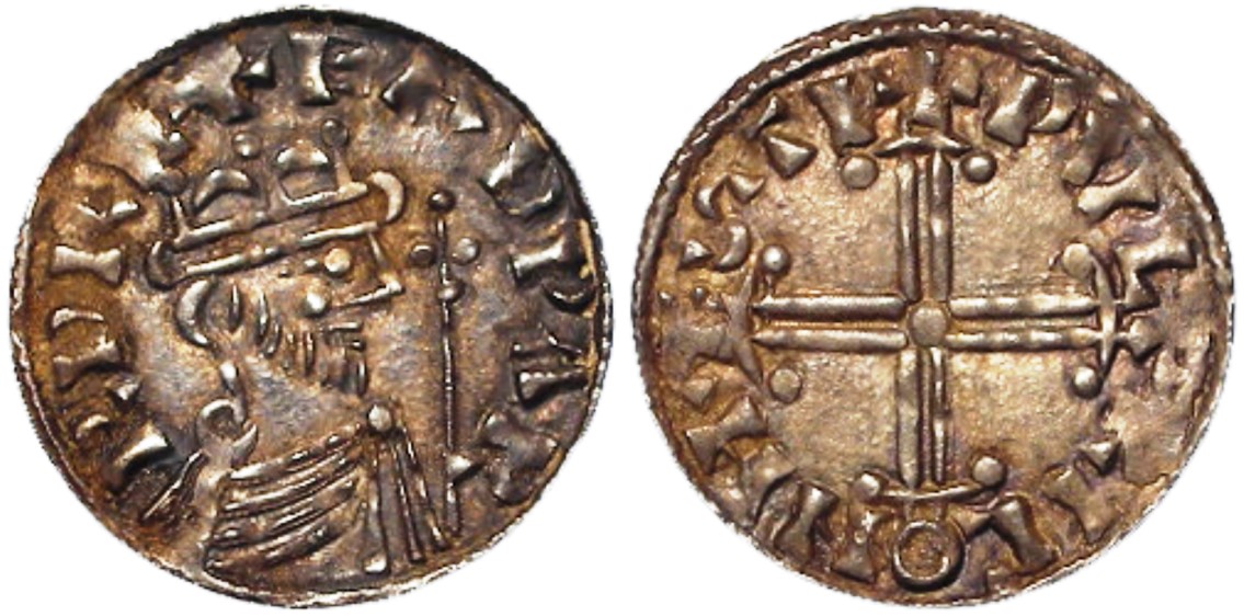
An Edward the Confessor silver penny minted at Hastings 1059-62.
1011 - The Anglo-Saxon Chronicle said that by this year the Vikings had over-ran much of southern England, including all Kent, Sussex, Surrey and ‘Haestingas’, showing that the Hastings area was still a significant and semi-independent locality.
1014 Sept 14 - A tsunami, possibly caused by an asteroid, caused major flooding along the southern coast of Britain. The chronicler William of Malmesbury wrote that the wall of water reached 'an astonishing size such as the memory of many cannot parallel.' The Anglo-Saxon Chronicle said that on this day 'came the great sea-flood widely through the land, and it ran up farther than it ever had, flooded many towns, and drowned countless human beings.' This could have caused significant damage to the port and coastline at Hastings, although there is no record of it.
1017 - Some of Hastings was included in the grant of the Manor of ‘Rameslie’ to the Norman Abbey of Fécamp by King Canute. This link with Normandy lasted four centuries, and may explain why the Normans chose Hastings as their 1066 base. Rameslie may have been Rye; the extent of its manor is unknown, except that it was to the north and east of Hastings, possibly extending into Kent. Hastings has always had closer cultural ties to Kent than to western Sussex, a feeling increased by it being the easternmost rape in Sussex (see 1069). The Abbey probably founded the original churches of All Saints and St Clement's on its land after the Norman conquest (St Clement's may have been built c1080).
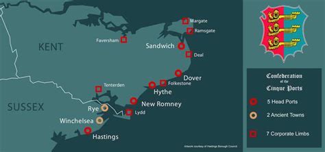
1050s - The five ports of Hastings, Romney, Hythe, Dover and Sandwich started working together because of their shared economic interests in fishing and trade, and because the Crown occasionally needed them to provide vessels for cross-Channel communications and for naval services. In the 12th century, when they were a more organised group, they become known as the Cinque Ports ('Cinque' is pronounced 'sink'). ‘Hastingaport’ is named on coins dated 1050.
1066 Sept 25 - King Harold’s army defeated the Vikings at the Battle of Stamford Bridge, near York, after marching there quickly from the south. But on September 28th the French, under William, Duke of Normandy, invaded England, landing on the coast, probably eastward of Cooden. (It is often said they landed at Pevensey, but this would have required a 26 mile march round the boggy Pevensey Levels inlet; Pevensey Castle was probably the only known landmark, and vessels would have been instructed to land to the east of it once it was sighted.) The Normans owned much land in Sussex at this time. William took over Hastings as his base, immediately erecting a pre-fabricated wooden fort, which had a motte and bailey. This was either on top of the West Hill, or on lower ground, now lost to the sea, to the south of the West Hill, where the Castle Rocks are today. This was the first Norman castle to be built in Britain. In the Bayeux Tapestry William appears to be burning the existing town. Harold marched back south, meeting William on 13 October to try to negotiate a settlement, but this failed.
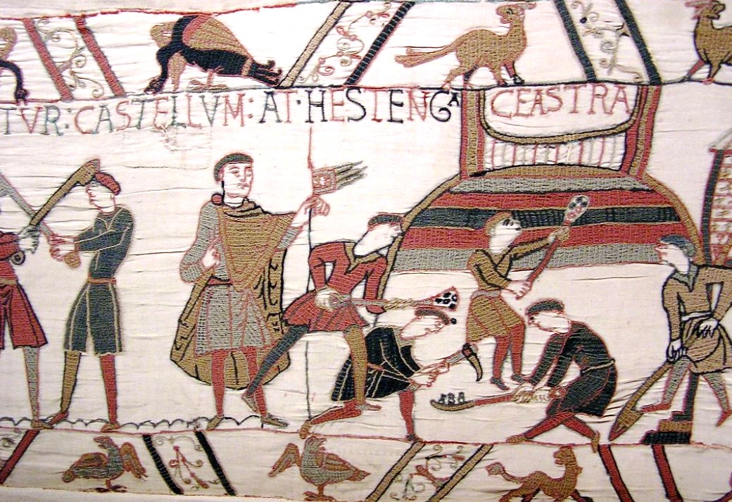
William's temporary fort being erected on the West Hill.
1066 Oct 14 - William won the Battle of Hastings, which took place six miles north-westerly inland from the port. He was crowned King of England in Westminster Abbey on 25 December.
1067-70 - William’s temporary wooden fort at Hastings was replaced by the beginnings of a stone castle. This may be the one that partially survives today, or it could have been on the lower ground, only to be washed away by the sea a few years later and then replaced by the current building. The original size of today’s castle was probably more than twice what it is now. Also in the late 11th century the collegiate church of St Mary was located inside the castle, remains of which still survive, but it is not known if the church was built at the same time as the castle, or before it. Over the following centuries, many changes and additions were made to the layout.
1069 - William I divided Sussex into six north-south strips (‘rapes’), each with a castle and seaport, designed to safeguard important passage routes between London and Normandy. The reliable Robert, Count of Eu, was given the Rape of Hastings, which was smaller than the territory of the Haestingas, as some of this was put in the Rape of Pevensey. The Count was given this land on condition he supplied 60 knights to serve the Crown. The Count was entrusted with the castle, the cross-Channel stop-off point, but his descendents were so frequently in rebellion against their king in the 11th and 12th centuries that the castle was seldom out of the monarch’s hand for many years at a time.
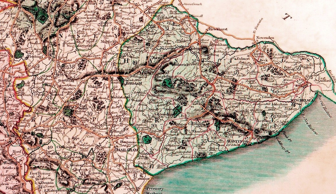
The Rape of Hastings is to the right of the green line, Pevensey to the left. In an 1801 map by John Cary.
1070 - The Count rebuilt the existing church in the castle as the Collegiate Church of St Mary, in honour of the Virgin Mary (the forerunner of today’s St Mary in the Castle Church).
1086 - There is no Hastings entry in the 1086 Domesday Book, but it seems likely that one was prepared and was designed to occupy the empty space at the head of the county survey, showing Hastings was the main town in the county. However, the Abbey of Fécamp is recorded as having four burgesses and 14 cottagers paying rents up to 63 shillings a year in ‘Hastinges’ (the old Hastings?), and a ‘new burg’ (the new Hastings?) has 64 burgesses returning £7 and 18 shillings.
1094 - William II assembled a large army, possibly around 20,000 men, in and around Hastings for an expedition to France for a possible conflict, but this was abandoned and the men were sent home. While waiting, William went to Battle to dedicate the newly-finished abbey there.
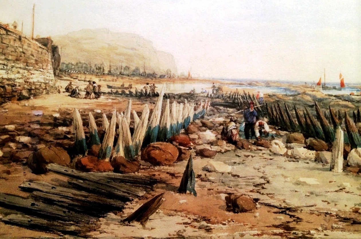
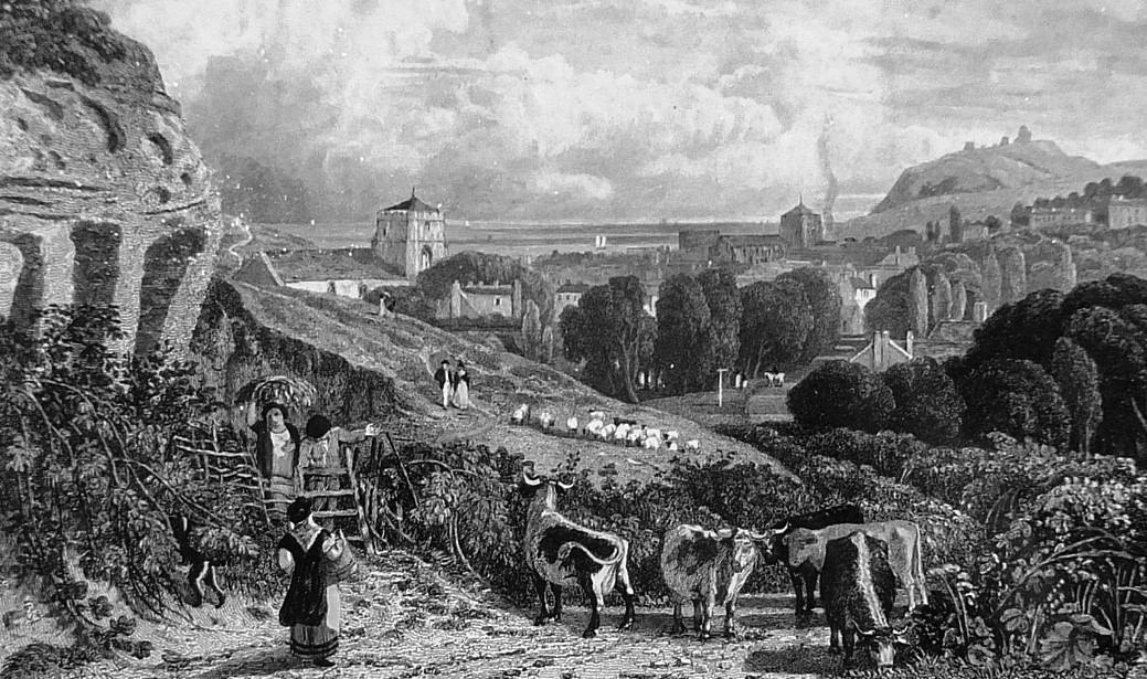
Late 11th Century - At around this time, or soon afterwards, the town of Hastings moved (or started moving) from the White Rock headland and Priory Valley into the Bourne Valley because of coastal erosion, sea damage, silting, and William’s burning of the town, if that took place. In the 12th century the town was sometimes called ‘New Hastings’. Today’s Old Town is clearly a result of town planning, because the High Street and All Saints Street are both straight and parallel, with the Bourne Stream running between them. They were also cut into the slopes of their respective hills, necessitating the roads and high pavements to be built before the houses. This town planning probably dates from immediately after the storms of the late 13th century, especially 1287, which caused major damage to much of the existing town. None of the Old Town houses pre-date 1377.
1154 - Arabic geographer Al-Idrissi described Hastings as ‘a town of large extent and many inhabitants, flourishing and handsome, having markets, workpeople and rich merchants’.
1154-58 - Henry II granted a royal charter to the Cinque Ports allowing them to engage in many normally illegal activities (including smuggling) as long as they supplied the Crown with a total 57 vessels for 15 days each year, in emergencies. Hastings was given special precedence in the charter as it was the only one of the five ports known to have had 'barons' before 1206. The charter - the first reference to the Cinque Ports as such - was probably just confirming in law what had been in practice for many decades.
Mid 12th Century - Hastings had reached its medieval peak of importance by the early 12th century, and from around the mid-century it began a decline in its fortunes, with its natural harbours silting up. The neighbouring ports of Rye and Winchelsea rose in importance.
1156 - It is possible that around this date Hastings was nearly destroyed by fire.
1162 - Henry II took possession of Hastings Castle and garrisoned it. Over the next 20 years much building work was carried out there, including a stone keep built c1171-74, in the south-east corner, now lost to the sea.
1180 - Fairlight Church was built, becoming an important landmark for seafarers for many centuries. It was demolished in 1845 and replaced on the same site by the present St Andrews Church.
c1189-99 - The Holy Trinity Priory, a small monastery belonging to the Augustinians (the Black Canons), was founded about this time by Walter de Scotney where Cambridge Crescent is today. The valley became known as the Priory Valley, and the Priory set up a large farm along the west side of the valley. The Priory left the town in 1417, but the farm remained in action, and was to play a role in the way the America Ground came into being.
1191 - Each of the five Cinque (pronounced 'sink') Ports had other towns, or ‘limbs’, attached to them, with Winchelsea and Rye being added to Hastings. These two soon outgrew Hastings, being able to supply more vessels, and by the 14th century they had become known as the ‘Ancient Towns’.
c1200 - By this time most of Hastings was in the Bourne Valley, with few buildings in the Priory Valley. But coastal erosion and sea incursion were starting to reduce the capabilities of Hastings as a major port.
1201 - King John while in Hastings issued his famous proclamation claiming sovereignty of the sea. Edward I made some additional sea laws here in 1274, after which there is no record of a royal visitor to the town until the 18th century.
1204 - Philip of France recaptured Normandy, reducing the significance of Hastings as a cross-Channel communications port.
1216 - Hastings Castle was partially dismantled on the order of King John because the knights who garrisoned it had not been supporting him in his unsuccessful struggle against the Barons, seeking more power. In 1225 the Crown took over possession of the castle from the Eu family and refortified it.
1260 and 1278 - In this, the most influential century of the Cinque Ports, the Crown gave the ports two charters of extra privileges as a reward for the important naval roles they were playing. But the decline of their harbours because of storms, flooding and silting meant that from around 1300 their maritime capability was reduced, and the Crown started cutting back its use of the licensed pirates. Hastings suffered especially hard from the decline of its harbour compared with the other ports during the 13th century.
1287 Feb 4 - Severe weather caused possibly the most serious flooding for centuries, probably damaging (if not destroying) most of the Old Town, and sweeping away the remains of the old town of Winchelsea. This was the culmination of decades of major storms, including in 1236, on 1 October 1250 (exceptionally bad) and 14 January 1252, all of which probably harmed Hastings significantly. Ground for a new St Clement's Church was made available in 1286, some way inland from its Norman site, and it was probably built then or soon after. Some of Hastings Castle was also probably lost to these storms and the coastline of eastern Sussex was changed. Some historians believe the storm of 1250 was the worst of all, largely destroying Winchelsea, and leading to the laying out of the new town of Winchelsea in 1283. It may also have caused the rebuilding of Hastings on a new layout (cf Late 11th Century).
1291 - The Taxatio Ecclesiastica of Pope Nicholas IV recorded that there were seven churches in Hastings. These were All Saints, St Clement's, St Andrew-sub-Castro (below the castle, in Castle Hill Road), St Michael (on White Rock) and on the coast further to the west were St Margaret (behind 50 Eversfield Place), St Leonard (Norman Road) and St Peter. The last three were soon lost to coastal erosion. At that time, St Clement's and All Saints were nearer to the sea, and may have been forced to move inland partly because of sea inundation. The current St Clement's was built around 1380, and today's All Saints soon after (it was described as 'new' in 1436).
1294 March 21 - A charity was created when Petronella de Cham donated five acres of land (known as the Maudlin Lands, lying mostly to the west of Bohemia Road) to support the Hospital of St Mary Magdalen. This was probably the first hospital in Hastings. In the following centuries the charity merged with others to form today’s Magdalen and Lasher Charity, which in the early 19th century owned 57 acres of farm land. Much of this land was sold for development in the following decades, creating St Leonards from Warrior Square Station north-east to Bohemia Road. But the charity was then being manifestly mismanaged, and the Charity Commission intervened in 1877-78, forcing the body to be run in a more democratic and legitimate manner.
1308 - Edward II, in a lifelong power struggle with the barons, ordered some improvements at Hastings Castle. It returned to a peacetime footing in 1322.
1331 - As Hastings Castle had been abandoned as a place of defence and was in severe disrepair, the Dean and Chapter of St Marys chapel were granted custody of it by Edward III, which they retained until 1546. Much of the cliff had fallen during the bad weather of recent decades. They enclosed the castle and built their dwellings within, but from here onwards it gradually fell into a state of decay from which it never recovered.
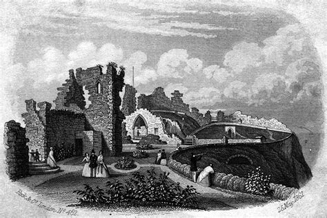
Hastings Castle in 1861.
1339 June - The town was plundered and burnt by a Franco-Genoese force, after burning Portsmouth, two years after the start of the Hundred Years War. This seems to have been the first serious attack on the English coast since the Norman Conquest. The Cinque Ports fleet retaliated a few weeks later, burning Boulogne. The castle was briefly brought back into use, under the command of William de Percy, but was returned to the Dean by 1343 and from then onwards never again played any significant military role. The oldest surviving houses in the Old Town date from after this time.
1340 - An inquiry was held into the damage done to the churches of St Michael (at White Rock), St Peter and St Margaret.
1343 and 1366 - The townspeople of Hastings pillaged the unguarded castle, imprisoning the resident clergy who then looked after it.
1344 - The register of Bishop Praty of Chichester said that in 1344 'several parishes at Hastings, including St Leonards and St Margaret's, were destroyed by the sea and depopulated,' In the 1340s there was a series of storms which severely damaged the coast and properties close to the sea. The Black Death in the late 1340s probably had a serious impact on Hastings.
1346-47 - In the year-long siege of Calais, Hastings, as one of the Cinque Ports, provided only five vessels and 96 men. England won. Throughout this century, Winchelsea and Rye made larger contributions to the King’s Navy than Hastings, reflecting its decline.
1366-67 - Sandstone from Fairlight was taken to Rochester Castle by sea.
1377 Aug - In their second major attack on the English coast since 1066, the French failed to beat Winchelsea, so they plundered and burnt Hastings and Rye. All Saints Church and St Clement's Church were both probably destroyed, and the castle lost (and never regained) its military role. No houses in the Old Town date from before 1377. This attack, and much sea damage in the previous century, turned Hastings into a small and poor port, a state it did not recover from until the late 18th century. Fishing was probably the town's main industry throughout this period, backed up by large-scale smuggling from the early 18th century. In 1380 a new St Clement's Church was built, on the same site, and it is now regarded as the town's main church.
1379 - In retaliation for the 1377 French attack, the Cinque Ports attacked and burnt several towns in Normandy.
1381 June - Richard II defeated the 'Peasants' Revolt', the near-revolution led by Jack Straw against the unfair poll tax, which sparked widespread social unrest in England.
Late 14th Century - By this time Hastings had become the most decayed of the Cinque Ports, owing to the long-term coastal erosion and silting. It was to be little more than a fishing port until the late 18th century, when it also started becoming a popular seaside resort.
Early 1400s - The existing All Saints Church was built, probably between 1417 and 1430. The site of its Norman predecessor, which was probably burnt down by the French in 1377, is unknown. It may have been where the new church was built, but was probably closer to the sea. It was possibly where the house called Pulpitt Gate now stands at the bottom of All Saints Street. where it may have suffered sea damage similar to the pre-1287 St Clement's.
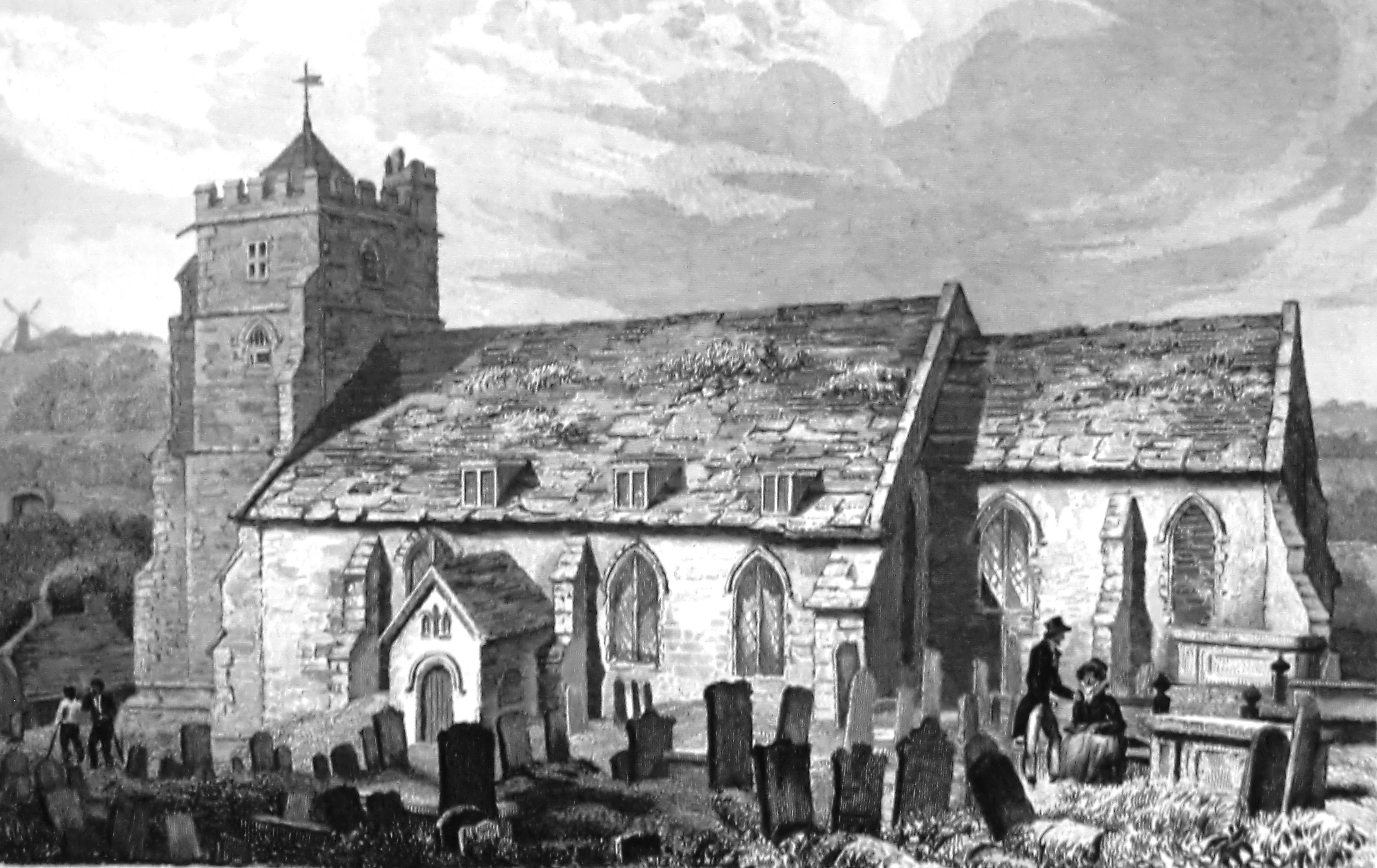
All Saints Church in 1824.
1403 - One of the first coast defence laws was passed in 1403, when Henry IV acted to secure England against an attack by ordering that such watches should be kept 'as they were wont to be in times past', probably from at least the early 13th century. A network of fire beacons along the coast, with links inland, was the main method for signalling the presence of enemy ships until the end of the 18th century. Each beacon also mobilised militia forces in its surrounding area, mustering bands of local people to fight off invaders. The system became highly organised during the 16th century, particularly when the Spanish Armada was expected in 1588. Fairlight always played a prominent role in this communications network, being the highest land between Beachy Head in the west and Hythe in the east. There is no record of the site of the beacons, but the highest point able to signal inland as well as along the coast was about 200 yards south-west of Fairlight Church (mostly quarried away during the Second World War). The church, built 1180, could also have been used, as its tower was visible all around for many miles.
1415 Nov - There was another great storm and an inroad of the sea.
1417 - Hastings Priory had suffered severe sea erosion in recent years, so it moved inland to Warbleton, east of Rushlake Green, on land granted by Sir John Pelham. This relocation of the Priory probably marks the final abandonment of settlement west of the castle, meaning the town of Hastings from then until the beginning of the 19th century was mainly confined to the Bourne Valley. The old Priory remained in minor use until its suppression in 1536, when it became a farm. The 1794 Hastings Guide said: 'Close to the farm yard is a piece of water, which being drained off a few years ago, discovered a large hole near 30 feet deep, with the remains of a fluice, deep gates and immense large timbers.'
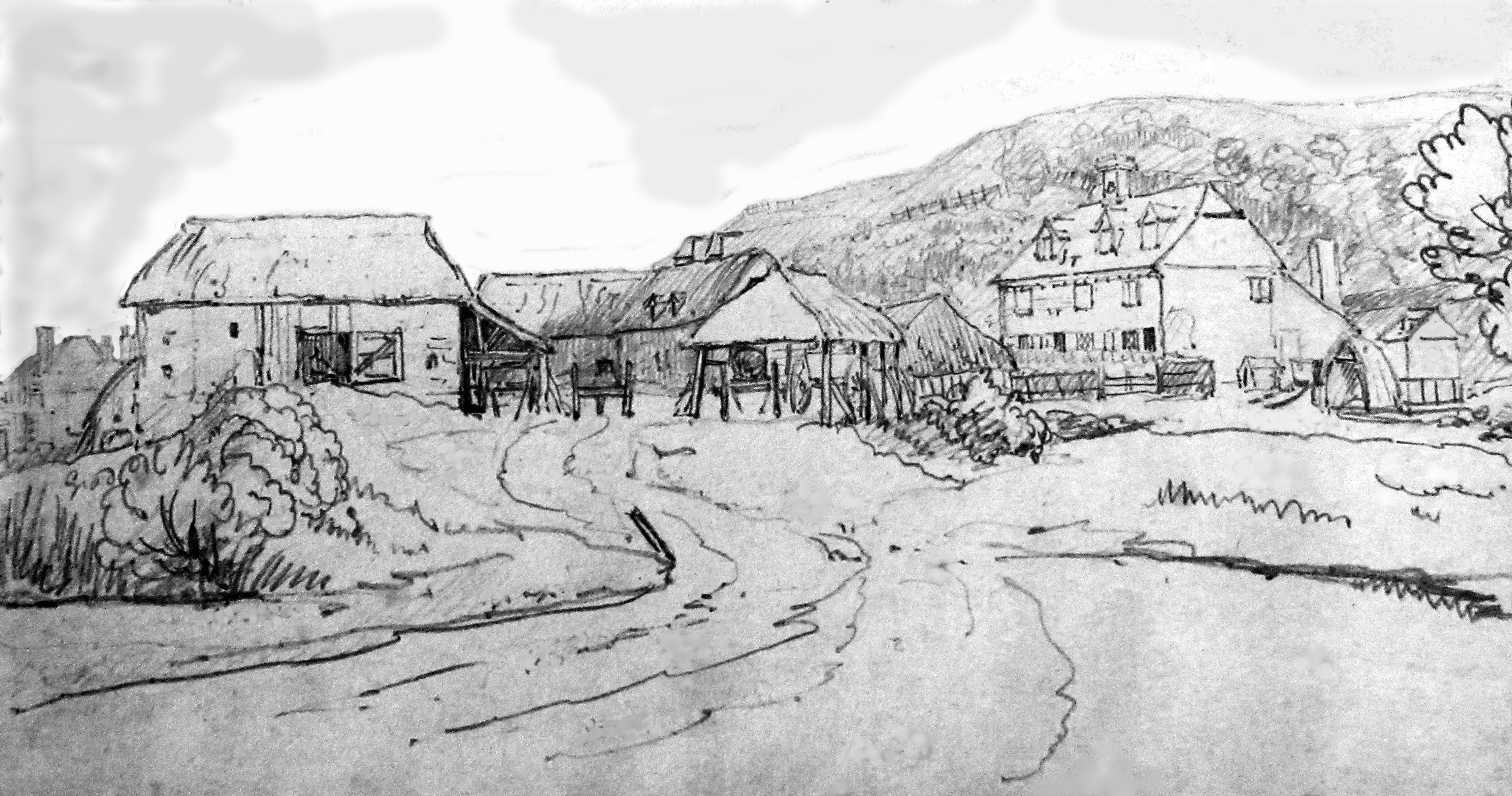
Priory Farm in 1821. It stood where the south end of Cambridge Gardens is today.
1419 Jan - Henry V won the battle of Rouen in Normandy in his successful war against France, of 1415-20. This gave him control of all Normandy property, including that of the Abbey of Fécamp which included the churches of All Saints and St Clement's.
1439 - A defensive ditch was dug across the marshes at the mouth of the Priory Valley.
1440 - In a survey, the parishes of St Michael and St Margaret were recorded as depopulated, and the parish of St Peter was completely absent.
1450 - Jack Cade led a rebellion of Kent and eastern Sussex people (including at least 11 from Hastings) in an unsuccessful attempt to create a better form of society.
1499 - A deed of 1499 refers to what is today called Tackleway as 'le tegill wey', probably meaning the way to the tile kilns.
1530 - By this time, the Swan Inn in High Street was established, and was to be the town's main inn though to the 19th century.
1536-38 - During the Reformation, when Henry VIII took ownership of all monasteries and their valuable land, the old Priory and its many acres were bestowed on the attorney general. (By the start of the 19th century, the Earl of Cornwallis had acquired three-quarters of it and the Milward family the rest.) In 1546, following the Reformation, Henry VIII passed on St Mary’s Church in Hastings Castle, along with much other land in Sussex, to Sir Anthony Browne, a prominent courtier. By this time the castle was in complete ruins. There was little more than the outside wall, plus a gate with chambers over it, some vaults and fragments of buildings.
1539-44 - In fear of an invasion by France, Camber Castle was built on a shingle spit to provide artillery protection for shipping entering Rye and Winchelsea. Some of the stone was taken from quarries at Hastings and Fairlight. The garrison was disbanded in 1637 as the eastward movement of the harbour entrance had made the castle obsolete.
1544 - A charter of Henry VIII described the state of Hastings as 'by the flux and reflux of the sea, and by the conflagration of our enemies, not only of lands and tenements, but also of inhabitants, reduced to waste, destruction and poverty.'
1548 - The French burnt about a tenth of the houses in Hastings. In this decade of increased trouble with France the Town Wall may have been built across the south end of the Old Town, from the junction of High Street and George Street to the bottom of All Saints Street. However, it is possible that a wall had been built there about 1385, and it was improved at this time. If it was built entirely in the mid-16th century, it would probably have been mainly anti-French, while a wall built c1385 would have been protecting the town from both the French and coastal erosion. Whenever built, it is assumed that there were no buildings, apart from fishermen's wooden work-huts, on the seaward side of it at that time, having been lost to the sea (and the French?). All buildings south of the wall - including all George Street -therefore date from after the mid-16th century. The beach level against the south side of the wall was several feet below the ground level on the north side, and the wall itself could have been about 20 feet high in places. The wall included three gateways. The Sea Gate was at the bottom of High Street, by No 58; it had been demolished by 1808. The Bourne Gate was where The Bourne road is today, by Winding Street. And the Pulpit Gate was a pedestrians-only gate at the bottom of All Saints Street. A large gun emplacement, called the East Fort, was built at the east end of the wall, although it may have been built several years, or decades (possibly in the 1590s), after the wall.
1550 - A deed referred to 'the Castle Hill called the Towte'. The word is derived from the Old English tot, meaning a look-out, other examples being Toot Rock at Pett Level and the Belle Tout lighthouse west of Beachy Head.
1563 - Almost 200 Hastings people were killed by an epidemic in the summer months.
1565 - There were 280 households in Hastings, suggesting a population of about 1,260, with fishermen accounting for 146 (52%) of the heads of households.
1578 - The town’s small harbour arm on the west side of the Old Town was washed away in a storm. Attempts were made to build another, but this was not completed, and a storm in 1589 or ’90 demolished it.
1579 - Christopher Caxton, the 'Father of Cartography', published his atlas of England and Wales that had taken him eight years to survey. It was the first detailed survey of its kind, and his maps were copied (sometimes inaccurately) many times by later generations of mapmakers.
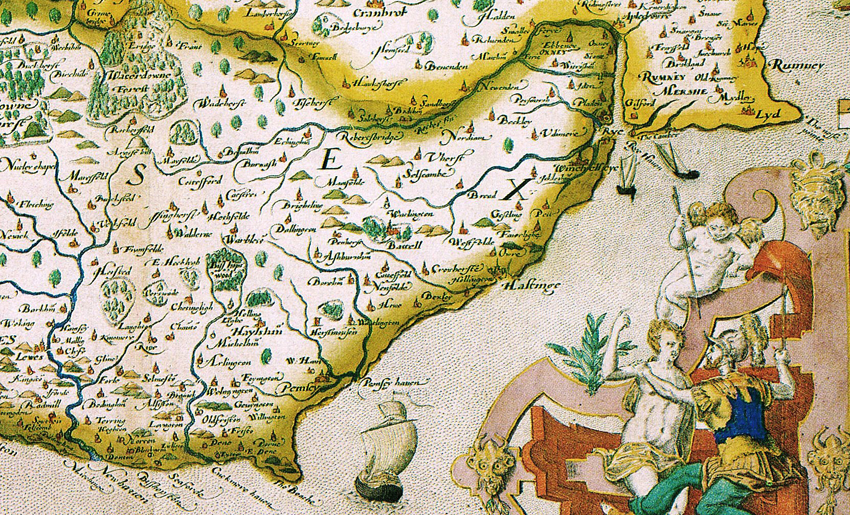
Part of Caxton's 1579 map of Sussex and Kent.
1580 - In 1578 some prominent local towns-people persuaded Queen Elizabeth to fund the turning of the marshy Priory Valley into a ‘haven’, a sheltered closed-in dock, like a marina. But after £2,000 (£930,000 in today’s money) had been spent on the scheme in about 1580, the rest of the finance went missing and construction stopped. However, a raised embankment had been built across most of the mouth of the Valley from the west side, lying roughly where Cambridge Road is today, as a barrier providing defence from the sea. This embankment immediately created a valuable road out of Hastings to the west, and as such was also to become the inland boundary of the America Ground two centuries later. But the embankment also blocked some of the Valley’s drainage channels, turning the bottom of it into marshland. This had a major effect on the expansion of the town, as the Valley could not be built upon until the mid-19th century.
1586 - The first-ever topographical survey of all the British Isles (Britain, by William Camden) said: 'The tradition is that the old towne of Hastings is swallowed up by the sea. … The haven, such as it is, being feede but with a poore small rill, is at the south end of the towne.'
1586 - Queen Elizabeth ordered the southern maritime counties of England, including Sussex, to prepare for the likely attempted invasion by the Spanish, much like the setting up of the Home Guard in 1940. About 4,000 foot soldiers had been mustered nationally by 1588, plus 260 horses. In February 1587 the Privy Council required that communications beacons should be put up, with a chain along the south coast, the nearest to Hastings recorded as being at Cooden and near Fairlight Church. In May 1587 an official survey of the Sussex coast described Bulverhythe as being a possible landing place, while there were 12 cannon at Hastings. The survey's map shows a battery on or below the cliff to the west of Fairlight, with Fairlight Church and the windmill on Fairlight Down being prominent landmarks.
1588 Aug - The Spanish Armada was routed by the English as it went up the Channel. Hastings could mobilise one large vessel, the 70-ton Bonaventure, plus 15 smaller craft, including several fishing boats.
1589 Feb 14 - A 'charter of incorporation' was granted by the Crown to leading people in the town to regularise unlawful land seizure they had carried out. It allowed them to set up a 'local authority', with a mayor, so that they could run the town in a more official-looking (but still privileged and undemocratic) way until the local government law was changed in 1835. From 1589 the authority was often called 'Hastings Corporation' until the 1835 reforms created Hastings Council.
1591 - The castle and the 'honour of Hastings' were purchased by the Pelham family, long-serving prominent members of the Sussex establishment who had been involved with Hastings Castle for almost two centuries, and who played an influential role in the town up to the 19th century. The castle remained derelict until 1824, when Lord Chichester, a member of the Pelham family, excavated and partly rebuilt it. The family sold the castle to Hastings Council in 1951 for £3,000.
1594 - A 1594 map of the Rye Harbour area in East Sussex Record Office shows a small hill called 'Toote', now called Toot Rock, at Pett Level. The name is from the Middle English word 'toten', meaning to watch, to look out. The rock is an outlier of the sandstone ridge which runs through Pett, and it stands out onto the marsh, and it was formerly an island. For many centuries it was a lookout base, a role which has persisted into recent times with the construction of Coastguard housing there in 1900 and watchtower/gun emplacements in 1940. There are many other places with a similar name around the UK.
1595 - The 1595 publication Speculum Britanniae, by John Norden, said Hastings seemed to have been a 'large city' because it had lost ten parish churches. From east to west these were: 'St George on the hill' [East Hill]; 'Allhallowes [All Saints] on the hill, whose ruins have built Allhallowes in the town'; St Mary in the Castle; St Andrews below the west side of the castle; 'Trinity within the Priory' [the Priory was where Cambridge Gardens is today]; St Michaels on White Rock, 'now fallen over the cliff'; Magdaline; St Margarets 'which daily falleth into the sea and the bones of dead carcases [bodies] are daily seen drop into the sea together with the church yard'; St Katharines; and St Leonards.
1595 - Major investment was made in a new harbour which the town urgently needed, using large blocks of stone abutting the remains of the wood harbour of 1578-80. But this was washed away in late 1596. Another attempt was made in 1597, using the wood, but a storm on 1 November 1597 destroyed it, leaving the town in considerable debt. Attempts were made to repair it, in 1611 and 1621, but then stopped because of lack of funds.
The remains of the 1597 harbour, seen here in the late 18th century.
1596 - It is believed that this was when Fishponds Farmhouse in Barley Lane was built. It is the oldest known building in that area.
1607 Sept - To combat the high risk of fire in the Old Town, Hastings Corporation paid for leather buckets, grapples, hooks and ladders to be hung in the two churches, on either side of the Bourne Stream where the water would come from.
1609 - From the Middle Ages through to the 19th century the Bourne Stream was the town's main water supply and drain, and this was a major health problem. There were many prosecutions for polluting the stream, with a typical case taking place in April 1609 when Stephen Tayler was fined 3s 4d (17p) for 'annoying the Bourne with keeping hoggs, ducks and such like'. A water system was set up in the 1830s and proper drainage in the late 1850s
1618 - Several disastrous fires in the town resulted in a ban on new houses having thatched roofs.
1619 Nov 15 - The Rev William Parker, rector of All Saints Church, in his will of this date left to Hastings Corporation 113 acres of land on the west side of Ore Valley the rents of which were to fund a school for local boys aged between ages six and eight inclusive. This, the town’s first school outside the castle, opened in 1639 in a house at the top of the High Street, where Torfield House is today. In 1878 his legacy helped pay for the creation of the Grammar School, later renamed the William Parker Comprehensive. Parker Road is part of that land.
1627 - Privateers from Dunkirk bombarded the town.
1643 July 9 - During the English Civil War, a detachment of the Parliamentary army led by Colonel Morley took over the Royalist-dominated town, meeting no resistance. All weapons were surrendered. The rector of All Saints fled during divine service, but was later taken and thrown into the Hastings gaol. That night some soldiers were billeted in All Saints Church.
1656 - There were more attacks by enemy privateers.
1656 Late - A storm wrecked the repaired 1597 harbour. No further attempts were made to build a harbour until 1896.
1663 - The Minnis Rock, below the north end of High Wickham, appears in a sketch, the earliest indication of the existence of the three caves there. The name comes from the Middle English word ‘menesse’ meaning common land. Both the East and West Hills were regarded as being common land. Inside, the date 1727 used to be visible carved on a wall.
The Minnis Rock and its residents in 1815.
1670 - Hastings had about 404 households, suggesting a population of about 1,820.
1676 - Hastings Corporation decreed that ships and boats could only be built to the west of the west fort, at the end of George Street, because the town beginning to expand out of the Borune Valley and the space on the beach was needed.
1678 - Samuel Jeake, a prominent Rye lawyer, in his book Charters of the Cinque Ports, written in this year, said about Hastings that the sea had 'covered with its Waves the old Town and Port, as some say three miles, and left this Town and Port of Hasting only a Stade Place'. He appeared to be referring to the late-13th century storms. He also said he was 'as yet uncertain' that it had happened.
1678 - Titus Oates (1649-1705) was a political and religious demagogue who was the chief fabricator of the Popish Plot, a spurious plan of 1678 supposedly hatched by the Jesuits to assassinate King Charles II, enthrone his Roman Catholic brother, James and restore the Roman Catholic faith as the state religion of England. This ignited widespread deep-seated anti-Catholic views throughout England, with much suffering as a result. Titus spent some of his youth in Hastings, where his father Samuel was the rector of All Saints Church from 1666-74. The anti-Catholic panic gradually died down as it became known that Titus was a deeply-dislikeable and foul-mouthed liar, and he was jailed for perjury in 1685.

Titus Oates.
1680 - The newly-established Board of Customs divided the British coastline into lengths called ‘Ports’, based around the most significant port in that area. Within each Port the Board defined which were the only legal quays and landing places for foreign trade. As part of this, in 1680 Sussex was split into five Ports, with Hastings designated a legal landing place in the ‘Port of Rye’. (These three words are painted on the sterns of Hastings fishing boats, because the 1843 Sea Fisheries Act required all fishing boats to be registered at their local Customs Port; hence also the letters RX in their registration number, meaning Rye, SusseX.) The Port of Rye ran from Jury’s Gap to Beachy Head, and the only other legal landing places within it initially were Rye and a quay at Pevensey Bridge, and each had Customs officers on duty, plus an office, often called the ‘Customs House’.
1683-84 - There was a great frost that winter, which froze the Thames, and caused much distress around the country.
1690 July - The English and Dutch navies were defeated by the French at the Battle of Beachy Head, and the badly-damaged British 70-gun warship Anne ran ashore at Pett Level, where much of her hull still lies at low water. The French later attacked Hastings from the sea, but without landing. As a result of this French hostility, two sea-facing artillery batteries were built in Hastings, one on the eastern corner of Rock-a-Nore Road and All Saints Street, where the cafe is today, and the other in what is now Pelham Place, just beyond the west end of George Street. The eastern battery seems to have been built on the site of the East Fort built in the mid or late 16th century, and one was recorded on the western site in mid-17th century. Both 1690 batteries were superseded in 1759 (cf) by a large battery built where the west end of the boating lake is today. The French again attacked Hastings in 1720. In either the 1690 or 1720 attacks cannonball struck St Clements Church and two of the balls were later installed high on the south face of the tower, where they are today.
1690s - There was a rapid escalation in armed and violent smuggling following the widening and increase of the customs and excise taxes, which imposed high import duties on luxuries such as tea, tobacco, brandy, wine and silks. The taxes were to pay the high cost of William III's wars in France, Scotland and Ireland. Smuggling was to be a major factor in the lives of many people in Hastings, of all social classes, from the 1690s until the taxes were relaxed in the early 1830s.
1695 Nov 15 - A large undecked French boat unloaded smuggled goods at Bulverhythe, aided by two Customs officers, including Mr Hall, the head officer at Hastings. The goods were then transferred to his Hastings house.